Hello Everyone,
Today I continue talking about my Route 66 trip I did in 2016. In my blog, Flip Flopping’ on my may to Springfield?, I ended with having dinner at the Cozy Dog Inn in Springfield, Illinois. Within Springfield you will find a number of alignments of Route 66. Regardless of which alignment you take on your way out of Springfield, there are only two alignments that go South; IL-4 and Highway 55.
I choose the IL-4 alignment because there were more geocaches on this stretch versus geocaches on the Highway 55 path. Both will get you to Staunton.
I drove through the town of Chatham and before I got to the town of Auburn there was a geocache I totally missed, Snell Road or Brick Road (GC6KDN9, hid by Chief STDNMB). This section of Route 66 is made of brick and I heard that if you drive this section that you might want to drive a little slower since some of the bricks are loose.
Then I drove through the towns of Auburn, Thayer, Virden, Girard, and Nilwood. There were a few geocaches scattered here and there, but none of the caches I was driving by had enough favorite points to make me want to stop. Also, I couldn't find any Route 66 related stops.
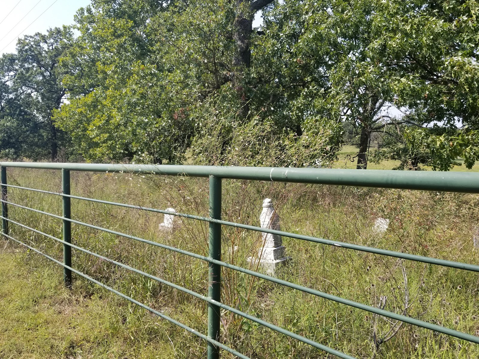
After Nilwood there is geocache on an old alignment called, Old Route 66 - Turkey Tracks (GC2HEJV, hid by awanderer, 24 favorite points), and somehow I missed getting this cache on my list for my trip. I did retrieve some pictures from the geocaching page and illinoisroute66.org.


According to illinoisroute66.org, “An original piece of the narrow 1926-30 Route 66 alignment winds south of Nilwood, parallel to the current straight configuration IL Route 4. Turkey tracks were imprinted in the 1920's when the original Route 4 concrete was poured, prior to its designation as Route 66. The story varies from a local farmer's escaped turkeys to wild turkeys as being the owners of the prints.”
The Mother Road goes from the Turkey Tracks and into Carlinville. At this point, the sun was going down and I needed to find a place to sleep for the night. I checked the phone and headed for a gem, Carlin Villa Motel. I don’t think it is an iconic stop, but if your travels have you in this general area at the end of the day, try staying here.

I could see this motel turning into a popular place for Route 66 roadies in the future.
The next morning I explored the town of Carlinville for a short while. There is a neat town square you’ll want spend a little time, walk around, see the businesses and pro-Route 66 set ups.
There is a small number of geocaches in town, but the only one I feel is worth getting is Million Dollar Courthouse (GC32CGH, hid by awanderer, 7 favorite points). I couldn’t find it the container, but this time it wasn’t my fault. The geocache went missing and was replace about a week later after I was there.
Here is what the geocache webpage says about the courthouse, “In early 1867 local government officials decided to build a new courthouse for Macoupin County. A four man commission was established and the cost estimate was $50,000. Bonds totaling that amount were issued for the project. In October of 1867 the first cornerstone was set in place. The cost escalated dramatically from then on. By January 1869 nearly $500,000 had been spent and building was still not complete. More bonds were issued, and by the time the courthouse was officially completed in 1870, the project had cost a staggering $1,342,000.00. This incredible price inspired the nickname of "Million Dollar Courthouse."
Rumors of misused appropriations also tarnished the project. Initially, the blame was laid on Judge Thaddeus Loomis and George H. Holliday the county clerk. Both men were part of the original four man commission. Judge Loomis was apparently innocent of any wrongdoing but we may never know the truth about Mr. Holliday because one night in 1870, he boarded a train out of town and simply disappeared.
At the time of its construction in 1870, the building was the largest county courthouse in the United States, and larger than the Illinois Statehouse. It is still recognized as the most magnificent courthouse in Illinois.”
I left Carlinville and started to drive to Gillespie. About halfway to Gillespie I stopped at an old bridge that had a geocache, Old Route 66 - Honey Creek Bridge (GC2AF5D, hid by awanderer, 4 favorite points). I grabbed my camera and recorded by find. Below is the YouTube version of it.
I drove through Gillespie and Sawyerville. Shortly after Sawyerville was another geocache I stopped at, Old Route 66 - A Tribute (GC2AM8E, hid by awanderer, 21 favorite points). This geocache is on an earlier alignment of Route 66 which is only about a mile long. It is an interesting tribute and if you go there you’ll see why.
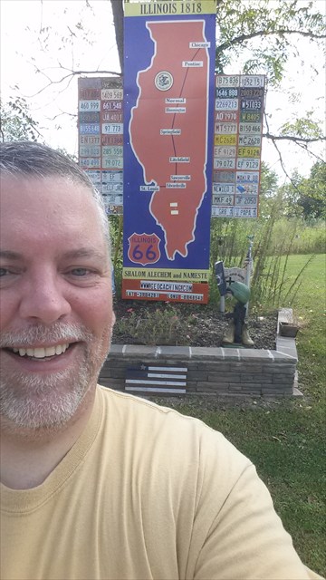
Here is what the geocaching webpage says about it, “This cache has been placed at this spot to make you aware of an interesting Route 66 display. The signboard has been created by Emil Fritz and exhibits the path of Old Historic Route 66 that was in use from 1926 to 1930. Also on display is very nice collection of Illinois license plates from 1948 through 1979. The State of Illinois stopped issuing annual plates in 1979 and initiated the license plate sticker program eliminating the year being stamped into the license plates. Emil, who lived just across the road from the sign, and his sons have spent considerable time creating and erecting this neat memorial.
In September of 2015 Mr. Fritz passed away. He will certainly be missed. Most memorable about Emil was his pleasant good natured and friendly demeanor.”
After I got back on the road, I hit the town of Staunton and that’s where I want to stop for now. I had a great time in Staunton and I get myself a great interview with Rich Henry of Henry’s Rabbit Ranch.
I didn’t go back and do the eastern alignment (Highway 55), but if in the future I do, I am adding these geocaches to my list....
Get Your Kicks on Route 66 (GC17HNQ, hid by NebulousNimrod, 1 favorite point)
RE66:IL The Ariston Story (GC1EJND, hid by Team Route 66/Chod, 32 favorite points)
Old Route 66 - Soulsby Station (GC35A98, hid by awanderer, 40 favorite points)
RT66:IL Get Your Kicks (GC15THV, hid by Vinpride, 58 favorite points)
Here are geocaches I might also get just because of namesake only. Note, these geocaches were just recently placed and was not available when I was traveling.
RT 66 second side 3 (GC6W4EB, hid by sewivy)
RT 66 second side 2 (GC6W45W, hid by sewivy)
Another Rt 66 Second Side (GC75R18, hid by sewivy, 1 favorite point)
Rt 66 second side (GC6BTWQ, hid by sewivy, 2 favorite points)
Rt 66 Motel no more (GC6WXHD, hid by sewivy, 3 favorite points)
Rt 66 second side 4 (GC6WXJ4, hid by sewivy)
Rt 66:IL A splitting of ways (GC7CNR1, hid by jvet)
Rt 66 historically speaking (GC6W441, hid by sewivy)
I might also add these caches if I got the time and because they are close to the Mother Road and have some favorite points...
There’s No Place Like Home! (GC2A7PR, hid by off looking, 3 favorite points)
Don’t eat the berries! (GC3YXE3, hid by zackfrillman, 19 favorite points) Only if I am going Northbound on Highway 55
NO LAST CHANCE FOR GAS (GC473CZ, hid my MA PA, 3 favorite points)
Weigh station prairie (GC2BRE3, hid by dver819, 3 favorite points)
That's it for now. Until next time, do me a favor and share this with your Route 66 Roadies and/or Geocaching Pals on your favorite social media.
Speaking of social media, if you haven't done so yet, friend me on Facebook (Rich Havlik) and follow me on Twitter (@richhavlik) to get notifications when I update this blog.
I'd love to hear what you think, so feel free to say something in the comment box below.
I had the time of my life on Route 66. I know you would too. But don't take my word for it, go and experience for yourself.
Peace,
Rich