Tuesday, October 3, 2017

Cemetery Tour on Route 66?

Hello Everyone,

Like I said in my last blog (Flip Floppin’ in Springfield, Sept 2017) that I was going to go back and forth from my 2016 Route 66 Travels and my 2017 adventures on the Main Street of America. Well, this is my first blog talking about my second trip.

I headed out September 9th from my humble home, in New Brighton, Minnesota, in my Man Van. My goal...drive to Joplin, stay the night there, and then hit the Mother Road. I ended my 2016 journey in Miami, Oklahoma which is 30-35 miles away from Joplin. At this point I was traveling alone and driving to Joplin was feasible to do in one day.

Instead of bolting to Miami, I decided to take some time to look for some geocaches and Route 66 related sites first. I am glad I did. The first stop I made was the Route 66 Mural Park.


If you take a closer look, you'll see that this mural is made of pictures of people from Joplin


The park itself isn’t all that big, but there are plenty of pictures that can be taken there.

Nearby the mural site was a geocache, Going Down? (GC4R68W, hid by whereisitnow!, 37 favorite points). It was a fun hide that had a bit of gadget feel to it. If you are geocaching, put this one on your list.

It was still early in the morning and I decided to find some geocaches that weren’t Route 66 related but was still on the Mother Road.

The next one I found was Smiley! (GC5WC7H, hid by chuck80198, 3 favorite points). It’s in what looks like a parking lot of an out-of-business used car lot. When you get there, you’ll completely figure out how this geocache got it’s name.

The next geocache I get is located in Schifferdecker Park and is nearby the Joplin History & Mineral Museum. You might see mention of this location in some your Route 66 books and/or apps on your phone. The cache is named, Electric Park (GC4BFAK, hid by Roadster, 44 favorite points) and when you get there you’ll see an outdoor collection of electrical equipment. The cache is a bit tricky, so pay attention to the hint on the cache page.

The museum wasn’t open yet so I went back onto Route 66 to find more geocaches.

One of the greatest things about geocaching is that it takes you to unexpected places and the next cache, Shewmake Cemetery (GC43XGJ, hid by Gracie & Me, 2 favorite points) was one of those places. This cache was hidden in an abandoned cemetery. Some of the grasses were thigh high and a lot of the headstones were very old. Take a look at the pictures.
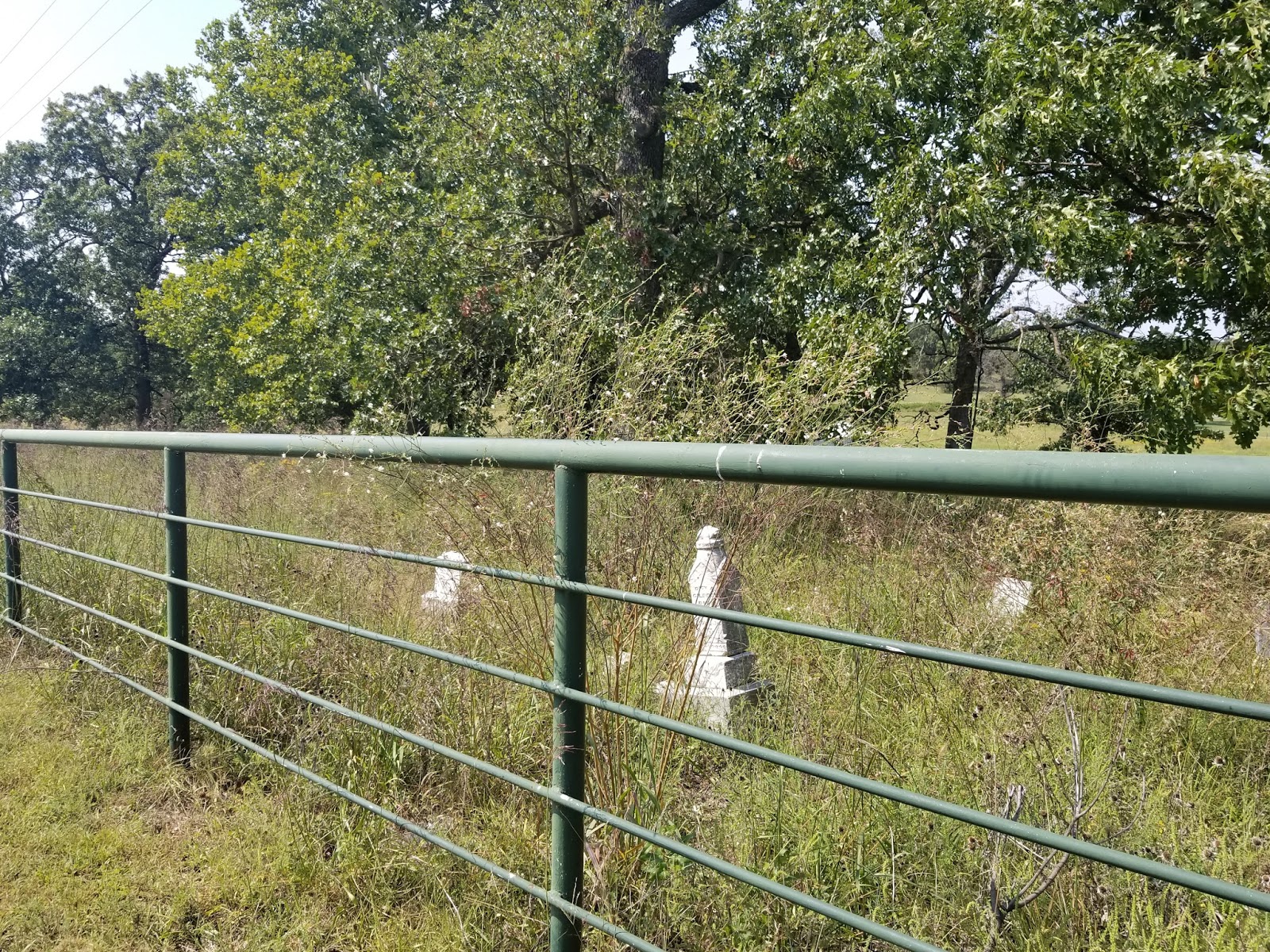


Being a funeral director, cemeteries, and especially abandoned cemeteries, can be fun geocaches even if they are not difficult to find.


I cross over into the state Kansas and into the city of Galena. I revisit some Route 66 related spots here....


There is a geocache hidden near the ancient jail, Route 66 -- Roadhouse Jail (GC4HFK3, hid by spiritguide, 29 favorite points) that continues to elude me. Been here twice and still can’t find it. Perhaps you’ll have better luck.

On my way out of Galena, I stopped at three other cemetery geocaches, Cemeteries of Cherokee County: Galena (GC497WV, hid by Ghostiegal, 23 favorite points), Hilltop Resting Place (GC4958G, hid by florida bum, 5 favorite points) and Stevenson Cemetery (GC1P1D7, hid by Keymaster angel, 4 favorite points). None one of the geocaches were hard to find, but the first cemetery cache did have a cute container.

After Galena I get to the town of Riverton. There are a couple of Route 66 related places you can visit here and there is even a Wherigo Geocache here, One of only three (GC5XXT3, set up by stearman5, 11 favorite points). The Wherigo app on my phone was not working right so I skipped this cache. I did however end up visiting a couple of places mentioned on the geocaching webpage, The Old Eisler Brother Store and one of Riverton’s original water towers.


According the geocaching webpage, The old Eisler Brother Store, built in 1925 and has been in continuous operation since before U.S. 66 became the official cross-country highway from Chicago to Los Angeles. Still operating as it did ‘back then,’ it serves as a stopping, shopping place for the small community of Riverton, as well as for travelers on Route 66. This building replaced the one that was destroyed by the tornado of 1923. The existing building originally had an open front porch, but the present closed in porch replaced that in 1933. It is one story, built of hollow, dark red bricks on a concrete slab foundation. The interior has changed little since 1925.”

It was around lunchtime so I did get myself a small lunch here and sat in the patio area. It felt nice and homey. After that, I go to an old water tower.


Compared to the picture on the geocaching webpage, this water tower is showing more of it’s age or it could be that it’s early September and the trees and bushes and weeds are making their final stand before Winter.

That’s it for now. Next time I talk about my 2017 trip, I’ll be in Baxter Springs, Kansas, where I have a great time finding a geocache on an abandoned bridge and then start my Route 66 travels in Oklahoma.

I had the time of my life on Route 66. I know you would too. But don’t take my word for it, go and experience for yourself.

Feel free to follow me on Facebook (Rich Havlik) and on Twitter (@richhavlik) for updates. Also, hit the subscribe button and that will give you updates as well.

Speaking of social media, do me a favor and share this blog with your Route 66 Roadies and/or Geocaching buddies on your favorite form of social media.

I’d love to hear your reaction to this, so please feel free to use the comment section below.

Thanks,
Rich


Tuesday, September 26, 2017

Flip Floppin' on my way to Springfield?

Hello Everyone,

Been a while, eh? Well I took a couple of weeks to travel Route 66. In 2016, I started in Chicago and ended in Miami, Oklahoma. So that’s where I started my travels for 2017. I drove solo from the Minneapolis/St. Paul area to Joplin, Missouri and stayed at a hotel. The next morning, I stopped at a couple of sites on Route 66 that my girlfriend and I missed in 2016 and eventually got to Miami and started fresh for my 2017 trip.

So here is where things might get flip-floppy on this blog. Some entries are going to be about my Route 66 travels in 2016 and some entries are going to be about my trip down the Mother Road in 2017. Don’t worry, I’ll have them clearly mark in the beginning of each blog. But I have a feeling that you’ll be more interested in the towns themselves (and any geocaches nearby) and not so much about being hardcore chronologically.

So here we go....

Driving down the Mother Road in September 2016

In my last blog post, I was in Lincoln, Illinois and then started down Route 66 and drove through the town of Broadwell where there wasn’t much in terms of Route 66 related stops or geocaches. 

I then came to the town of Elkhart. I did stop for a non-Route 66 related geocache, Elkhart Memorial (GC3K78K, hid by SEARCH PARTY, 4 favorite points). It’s a nice little town honor for veterans and the hide itself wasn’t all that remarkable, but stopped at this point because it had more than a couple of favorite points.

I then hit the town of Williamsville. There wasn’t any route-related geocaches, but there is a Route 66 related stop, Old Station.


According to legendsofamerica.com, “Old Station, a converted 1930s service station surrounded by old cars and memorabilia. The inside is a blast-from-the-past, with walls filled with a huge inventory of die-cast cars, Coca-Cola collectibles and Route 66 memorabilia. Open most afternoons.”

But when I got there, no one was around and it looked like it might have been in repair mode.


This isn’t the first time I came across a Route 66 Related stop in a rebuilding state. I also have a feeling it won’t be the last.

I drove on and came into the city of Springfield.

I could only find one route-related geocache in Springfield, so I first went for a heavily favored virtual cache, The Oak Ridge Tour (GCE6FF, set up by Rod & Shelby, 189 favorite points). When I entered into the cemetery, I knew right away I had to take the video camera with me. Below is a YouTube version of my experience there.


It was hard getting upbeat in a cemetery video. Walking through Lincoln’s Tomb was somewhat somber. If you go there, read up on the trials of taking care of Lincoln’s body and go seek out the other locations that are mentioned with this cemetery’s history.

After my time spent at the cemetery I went for the 1 route-related geocache and it couldn’t have happened at a better time...dinner. RT66:IL Gettin’ Cozy (GC1E4E7, hid by searching simpsons, 10 favorite points) is in the parking lot of Cozy Drive Inn...the birthplace of the corndog on a stick.


Here is the history of the corn dog according to their website, cozydogdrivein.com...

“In Muskogee, Oklahoma, I saw an unusual sandwich called “corn-dog.” This sandwich was a wiener baked in cornbread. The corn-dog was very good, but took too long to prepare. The problem was how to cover a hotdog with batter and cook it in a short time.

In the fall of 1941, I told this story to a fellow student at Knox College whose father was in the bakery business, and then gave it no further thought.

Five years later while in the Air Force stationed at Amarillo Airfield, I received a letter from my fellow student, Don Strand. To my surprise he had developed a mix that would stick on a wiener while being french-fried. He wondered if he could send some down that I could try in Amarillo. Having plenty of spare time, I said ‘yes.’

Using cocktail forks for sticks, the U.S.O kitchen in which to experiment, we made a very tasty hotdog on a stick, that we called a “crusty cur.” They became very popular both at the U.S.O. in town, and at the P.X. on the airfield. My friend continued to send mix and we continued to sell thousands of crusty curs until I was discharged – honorably – in the spring of 1946.

We decided to sell them that spring. My wife did not like the name “crusty curs.” Through trial and error and discarding dozens of names, we finally decided on the name “Cozy Dogs.”

Cozy Dogs were officially Launched at the Lake Springfield Beach House on June 16th, 1946.”

This story was told by Ed Waldmire Jr. to his son Bob, during an “interview” on January 30th, 1959. Bob was in the 8th grade at the time.

After the Cozy Dogs were launched at the Lake Springfield Beach House, Cozy Dogs were introduced at the Illinois State Fair the same year.  The first Cozy Dog House was located on South Grand between Fifth and Sixth Street in Springfield.  A second Cozy Dog House was located at Ash & MacArthur.  In 1949, Drive In was born; built on “Route 66” South Sixth Street.  In 1996 Cozy Dog moved to its current location, where Sue (Ed’s daughter in law) Josh, Eddie, Tony & Nick (Ed’s grandsons) continue on with the business right next door to the original location.


That’s it for now. But if you want to be notified of any updates, hit the subscribe button.

Let me know what you think and write something down in the comment box.

Feel free to follow me on social media...Look me up on Facebook (Rich Havlik) and on Twitter (@richhavlik).

Speaking of social media, share this blog and let others know more about Route 66 and all the Geocaches nearby.

Had the time of my life on Route 66. I know you would too. But don’t take my word for it, go experience it for yourself.


Rich